
I remember standing in a semi-submerged semi-detached in Bristol back in ’98, the smell of silt and damp drywall thick enough to chew on. The homeowner was pointing at a glossy, expensive-looking topographical map he’d bought online, swearing his property was in a “low-risk zone.” He’d spent hundreds on a fancy consultant, yet he was still staring at a ruined living room because he’d focused on the wrong metrics. That’s the problem with the industry today; people think how flood risk should be assessed is a matter of buying the most expensive data set or a high-tech simulation. In reality, most of those fancy models miss the local realities—the blocked culvert three streets over or the way the new housing estate uphill has changed the runoff pattern.
I’m not here to sell you a premium survey or tell you that every drop of rain is a catastrophe. What I am going to do is tell you how to look at your property through the eyes of a man who has seen the aftermath of a failed assessment. I’ll show you how to bridge the gap between a generic risk score and the actual wording in your policy, so you aren’t left holding a useless piece of paper when the water starts rising.
Beyond the Map How Flood Risk Should Be Assessed
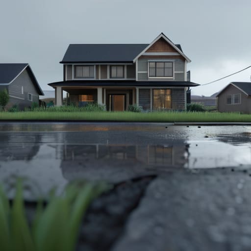
Most people think a flood map is the final word, but in my experience, a map is just a snapshot of what happened yesterday. If you’re relying solely on a government color-coded zone, you’re missing the nuance that actually determines whether a claim gets paid or denied. You need to look at the topographic data for flood analysis specific to your exact plot. I’ve seen houses sitting just outside a designated high-risk zone that ended up under two feet of water simply because they sat in a natural depression that no mapmaker bothered to highlight.
It isn’t just about where the water comes from, either; it’s about where it goes when it can’t get in. You have to consider the stormwater runoff patterns of the surrounding developments. If a new housing estate went up down the road last year, the way water moves through that soil has changed, regardless of what the old flood maps say. Assessing risk properly means looking at the ground, the drainage, and the changing landscape, rather than just trusting a piece of paper printed five years ago.
The Math of Misery Why Hydrological Modeling Techniques Matter
Most people think a flood risk assessment is just a colored map with red and blue zones, but if you’re relying solely on those, you’re already halfway to a denied claim. In my years adjusting losses, I’ve seen plenty of homeowners who thought they were safe because they weren’t in a “high-risk” zone, only to find out their property sat in a natural basin that the maps missed. This is where hydrological modeling techniques actually matter. It isn’t just about where the river has been; it’s about how the water behaves when the ground is already saturated and the drains are choked.
You have to look at the actual physics of the land. I’m talking about how stormwater runoff patterns interact with the specific slope of your driveway or the height of your foundation. A generic map might tell you the river stays in its banks, but it won’t tell you how a sudden, intense downpour will turn your backyard into a temporary lake. If the assessment doesn’t account for the specific way water moves across your particular patch of earth, you aren’t looking at a risk assessment—you’re looking at a guess.
Hidden Variables Using Topographic Data for Flood Analysis
Most people assume that if they aren’t sitting in a known floodplain, they’re safe. I spent three decades seeing that assumption crumble. You can have a house that sits well outside the official red lines on a government map, yet still find yourself standing in two feet of water because of a localized depression or a poorly graded driveway. This is why relying solely on static maps is a mistake; you need to look at the actual topographic data for flood analysis to understand how water moves across a specific piece of dirt.
It isn’t just about the river breaching its banks; it’s about the micro-terrain. I’ve seen claims where the damage wasn’t caused by a rising river, but by how stormwater runoff patterns were diverted by a new retaining wall or a neighbor’s paved patio. If the land slopes toward your foundation in a way the surveyor didn’t note, your policy might treat that as a drainage issue rather than a sudden flood event. In my experience, the difference between a covered loss and a denied claim often lives in those few inches of elevation that the standard maps simply ignore.
The Unseen Shift Climate Change Impact on Flooding Patterns
The trouble with most people’s approach to risk is that they treat a flood map like a static document, something carved in stone. But I’ve spent enough years looking at damage reports to know that the ground is moving under our feet. The climate change impact on flooding isn’t some theoretical debate for academics; it is a practical reality that renders old data obsolete. We are seeing weather patterns that don’t follow the historical precedents insurers used to rely on when setting their baseline risks.
If you are relying on a risk assessment from ten years ago, you are essentially flying blind. We are witnessing a fundamental shift in stormwater runoff patterns, where the sheer volume of water during a single event can overwhelm even well-designed drainage systems. It isn’t just about more rain; it’s about the intensity and frequency of these events outstripping the capacity of our current infrastructure. When I see a claim for a property that was “low risk” on paper, it’s usually because the policy was built on a version of the world that no longer exists.
The Payout Trap Why Stormwater Runoff Patterns Break Policies
I’ve stood in more living rooms than I care to count, watching people stare at waterlines on their baseboards, only to realize their policy doesn’t cover the way the water actually got there. The problem is that most people think of a flood as a river breaking its banks, but in my experience, it’s often the stormwater runoff patterns that cause the most headache. You might be miles from a river, but if your local drainage can’t handle a sudden deluge, that water isn’t “flooding” in the traditional sense—it’s surface water or flash flooding.
This is where the distinction between a “flood” and “surface water” becomes a legal battlefield. If your policy is strictly worded toward rising river levels and fails to account for the way rain cascades off a neighbor’s new paved driveway, you are looking at a massive gap in coverage. I’ve seen many a claim denied because the topographic data for flood analysis showed the property was on a slope that funneled runoff directly into the basement, a scenario the policyholder assumed was covered under standard perils. It isn’t.
Five Ways to Stop Guessing and Start Assessing
- Stop relying on a single flood map. A government map is a useful starting point, but it’s a snapshot in time, not a crystal ball. You need to look at historical local data—what actually happened in the street during the last big storm—because the map often lags years behind the reality of the terrain.
- Look at the ground, not just the water. When you’re assessing risk, you have to consider the “impermeable surface” factor. If your property is surrounded by new concrete developments or expanded parking lots, that water has nowhere to go but into your basement, regardless of what the official flood zone says.
- Check the drainage capacity, not just the river level. I’ve seen plenty of claims denied because the water didn’t come from a rising river, but from a municipal sewer system that couldn’t cope. If the local infrastructure is aging or undersized, your “low risk” zone is a lie.
- Verify the “source” of the water. This is where the policy wording gets teeth. You need to assess whether your risk is fluvial (river), tidal, or surface water (pluvial). If you’re assessing a property thinking it’s safe from rivers, but the real threat is heavy rain pooling in the driveway, you’ve miscalculated your exposure.
- Don’t ignore the elevation of the utilities. A proper assessment isn’t just about whether the floor gets wet; it’s about where the electrical mains and heating systems sit. If the water reaches the sockets, the loss isn’t just a damp carpet—it’s a total structural rebuild, and that’s a much higher tier of risk than most people realize.
The Adjuster’s Bottom Line
Don’t rely on a generic flood map to tell you if you’re safe; those maps are often outdated and don’t account for the specific way water moves across your particular patch of ground.
Understand that “flood” is a legal term, not just a weather event, and if your loss is caused by something the policy defines as stormwater runoff rather than a rising body of water, you might be holding an empty contract.
The gap between what you think you’re covered for and what the technical modeling actually predicts is where most claims fail, so stop looking at the premium and start looking at the topographical reality of your property.
The Reality Check
At the end of the day, assessing flood risk isn’t just about checking a box on a government map or trusting a single hydrological model. It’s about understanding that risk is a moving target, shaped by everything from the subtle slope of your driveway to the way a changing climate alters historical patterns. If you only look at the surface-level data, you’re leaving yourself exposed to the kind of unforeseen variables that turn a manageable incident into a total financial loss. You have to look past the glossy brochures and understand that a policy is only as good as the data used to price it; if the assessment is shallow, your actual coverage will be even shallower when the water starts rising.
I’ve spent nearly four decades watching people realize too late that their “flood zone” designation didn’t tell the whole story. My advice isn’t to panic, but to be precise. Don’t buy insurance based on a feeling or a cheap premium; buy it based on a clear-eyed understanding of your specific topography and the shifting realities of our environment. Knowledge is the only thing that bridges the gap between a devastating disaster and a successful claim. Take the time to ask the hard questions now, because once the damage is done, the wording is fixed, and the truth won’t change just because you wish it would.
Frequently Asked Questions
If the hydrological models and maps say I'm in a low-risk zone, but I've seen water pooling in my driveway every time it pours, which one actually matters when I file a claim?
The short answer? The map matters to the insurer’s pricing, but the water in your driveway matters to your claim. If your policy defines a flood as “surface water from an external source” and that pooling is actually runoff from a neighbor’s poorly graded land, you’re in business. But if the policy excludes “sewer backup” or “surface water accumulation” due to poor drainage, that map won’t save you. Read your definitions before the next downpour.
Does a change in the local topography—like a new housing development or a paved parking lot nearby—legally change my risk profile, or am I stuck with whatever the insurer's current map says?
Legally? You aren’t “stuck,” but you are in a race against a slow-moving bureaucracy. A new parking lot changes the way water moves across the land, period. However, your insurer doesn’t update their maps every time a bulldozer moves dirt. If your risk has spiked because of local development and your policy hasn’t been adjusted, you’re essentially paying for a version of reality that no longer exists. Check your wording on “material change in risk.”
When an adjuster arrives after a flood, are they looking at the same climate change data we're discussing, or are they strictly bound by the specific definitions of "flood" written in my policy wording?
I can tell you right now: the adjuster isn’t looking at climate models; they’re looking at your policy definitions. While a scientist sees a shifting hydrological pattern, an adjuster sees whether the water entered through a breach in a riverbank or a blocked storm drain. We aren’t there to debate global warming; we’re there to see if the event matches the specific “Peril” listed in your contract. If it doesn’t fit the wording, the science won’t save your claim.